Date released
22 February 2023

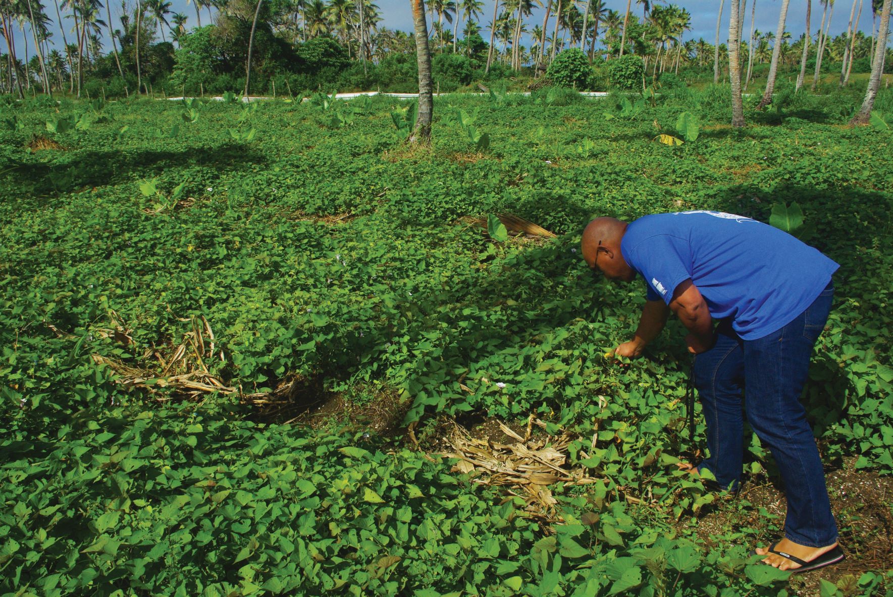
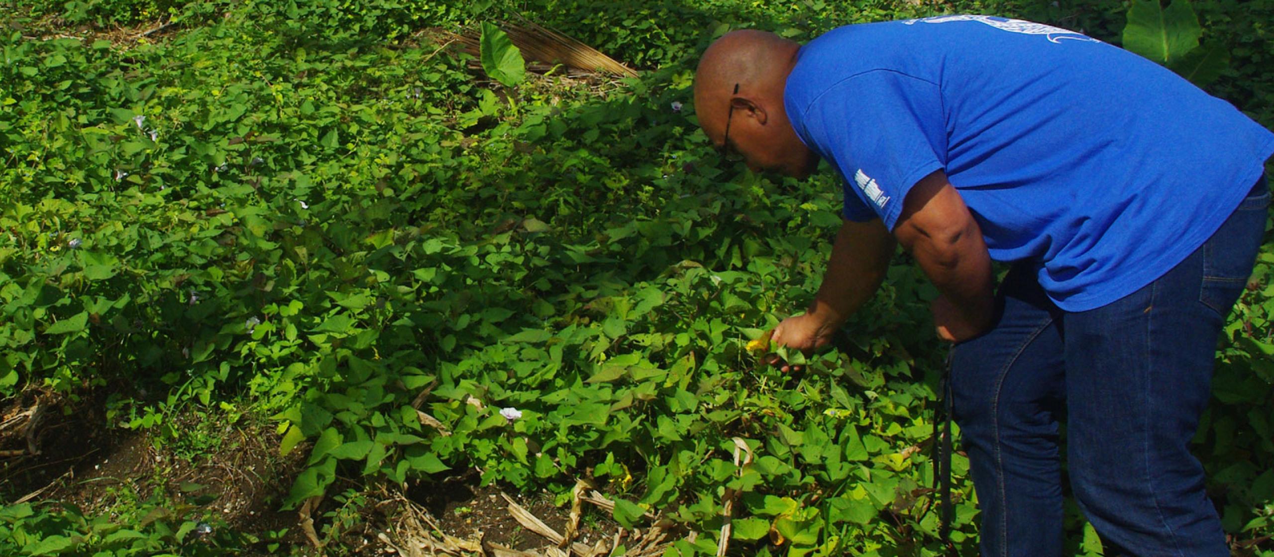
A few years ago, Dr James Quilty was standing in a taro crop in Samoa, chatting with the grower about his cultivation methods and his farming ambitions. Dr Quilty noted, as they were speaking, the yellow-tinged leaves of the taro crop being symptomatic of potassium-deficient soils.

As the ACIAR Research Program Manager, Soil and Land Management, he had a keen interest in this issue. Dr Quilty asked if the farmer used fertiliser, given he had just won the best taro prize in his local agricultural show.

‘No’ was the unsurprising answer. As the conversation continued, the farmer lamented how the taro plants used to be twice as tall when he was a boy.

This conversation revealed 2 important facts: crop growth and soil nutrition were in decline, but farmers were not linking the 2.

What was needed was soil test data and a way to show farmers the connection between this data, their soil management, the diminishing performance of their crops over time and the long-term impacts for their families and their children.

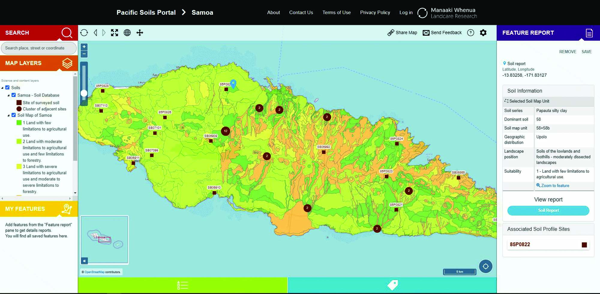
Fast forward 3 years to the development of the Pacific Soils Portal. Created through a CSIRO-led ACIAR-supported project, the portal brings together 50 years of soil test data from Samoa, Fiji, Tonga, Kiribati and Tuvalu into an online data map.

Soil history exposed

The soils portal allows farmers, researchers, extension agents and other stakeholders to compare changes over time for critical elements such as soil carbon, nitrogen, phosphorous and other nutrients, and the consequences for farm productivity.

It is also geo-referenced, which allows information to be correlated with cultivation practices at farm or district level. The historical data used to create the digital maps for the 5 participating Pacific island countries were compiled by geospatial specialist Mr James Barringer from Manaaki Whenua – Landcare Research in New Zealand.

Leading this research project, Mr Barringer’s job was to locate half a century of accumulated soils knowledge from archives of earlier work funded by Australia, New Zealand and the FAO, working with the Pacific Community (SPC) and in-country agricultural ministries.

Screen grab of Samoan sites in the Pacific Soils Portal
A map of soils in Samoa, created as part of the Pacific Soils Portal. Image: James Barringer

He then had to turn this into a useable reference that would allow farmers and extension officers to see how soil nutrition had deteriorated and to use this as motivation for adopting improved practices. There were obvious issues working with hand-drawn maps and soil survey sheets from up to 40 years ago.

‘Some of the old soil maps were fantastically detailed, while other locations were descriptions like “banana plantation, 500 yards N of HQ of church mission station, SW corner of island, near Longamapu, Vava’u”,’ said Mr Barringer.

Fitting this information to modern-day GPS coordinates was challenging; however, with painstaking cross-references to photos and area maps, the data in the portal is reliable to within tens of metres.

The concept of the Pacific Soils Portal and its role in raising awareness of declining soil nutrition was first raised more than 15 years ago by SPC but shelved in the aftermath of the global financial crisis (2008).

It was revived as an ACIAR-supported project on the back of the larger Pacific soils project in partnership with the 5 Pacific countries (Samoa, Fiji, Tonga, Kiribati and Tuvalu) and New Zealand, and the portal project is now complete.

Practical extension tool

Dr Quilty said the soils portal is expected to be a valuable extension tool to help farmers raise product quality to export standards.

He explained, for example, that there is a strong demand for taro among Pacific islander communities in Australia and New Zealand but a gap has been opening between quality expectations and what is being grown.

‘But the farmers aren’t getting the information they need in a way that helps them make the practice changes required to meet these export opportunities,’ said Dr Quilty. ‘That’s where the soils portal fits in.’

The data and maps can continue to be updated and linked with other databases such as those covering biodiversity, ecosystems and infrastructure.

‘If someone wants to invest in agriculture in, say, Fiji, the decision isn’t just about soil health, but biodiversity, infrastructure and market access,’ said Dr Quilty. ‘All of these elements can be overlaid to create a comprehensive picture of the agricultural landscape and how it is changing.’

Tonga soils researcher bending down in green field
Tonga soils researcher Dr Siosiua Halavatau examining the effects of boron deficiency in beans. Photo: James Barringer

Another crucial aspect of the soils portal project has been the local application of mid-infrared spectroscopy (MIR). This provides detailed insights into changing soil chemistry and why soils are becoming less fertile and more prone to drought and erosion. It also cuts soil testing costs from around $300 a sample to less than $5.

‘It’s a game changer,’ said Dr Quilty. ‘A smallholder farmer is not going to send off multiple samples for analysis if it’s going to cost $1000, but possibly will if soil information and recommendations can be provided for less than $20.’

Researcher with the Fiji Ministry of Agriculture, Ami Sharma, said MIR provided enhanced capability to rapidly and economically analyse large numbers of soil samples, overcoming challenges such as tight resources and budgets.

In the future, spectral analysis of soils will be possible in the field, with the soils portal providing the digital infrastructure to support near real-time soil analysis.

‘Logged in the portal, this data shows where we’re going and where we need to go in terms of soil health,’ said Dr Quilty. ‘It supports conversations between farmers, policymakers, development agencies, and creates a whole new digital infrastructure for agricultural development.’

ACIAR PROJECT: ‘Soil management in Pacific Islands: investigating nutrient cycling and development of the soils portal’ (SMCN/2016/111)